Τετάρτη 27 Ιουνίου 2012

Tinos - Τήνος


Tinos (Greek: Τήνος) [ˈtinos] is a Greek island situated in the Aegean Sea. It is located in the Cyclades archipelago. In antiquity, Tinos was also known as Ophiussa (from ophis, Greek for snake) and Hydroessa (from hydor, Greek for water). The closest islands are Andros, Delos, and Mykonos. It has a land area of approximately 194 square kilometres and a 2001 census population of 8,574 inhabitants.

Between 1207 and 1715, Tinos was in Venetian hands. From 1715 to 1821, Tinos was ruled by the Ottoman Empire before joining in the Greek War of Independence. It was known İstendil during Ottoman rule.

Tinos is famous amongst Greeks for the Church of Panagia Evangelistria, its 80 or so windmills, about 1000 artistic dovecotes, 50 active villages and its Venetian fortifications at the mountain, Exobourgo. On Tinos, both Greek Orthodox and Roman Catholic populations co-exist, and the island is also well known for its famous sculptors and painters, such as Nicholaos Gysis, Yannoulis Chalepas and Nikiforos Lytras.

The island is located near the geographical center of the Cyclades island complex, and because of the Panagia Evangelistria church, with its reputedly miraculous icon of Virgin Mary that it holds, Tinos is also the center of a yearly pilgrimage that takes place on the date of the Dormition of the Virgin Mary (August 15, "Dekapentavgoustos" in Greek). This is perhaps the most notable and still active yearly pilgrimage in the region of the eastern Mediterranean. Many pilgrims make their way the 800 metres from the ferry wharf to the church on their hands and knees as sign of devotion. The day also commemorates the 1940 sinking of the Greek cruiser Elli by an Italian submarine on August 15, 1940 at Tinos's harbor.

Geography
Tinos has a varied landscape. From the shores of Panormos and Kolimbithra on the North Shore to Kionia, Agios Yannis O Portos, and Agios Sostis on the Southern Shore, Tinos has many beaches, just to name a few. Tsiknias is the highest mountain on the island at 750 meters and hides the quaint village of Livada. The mountain of Exobourgo is quite distinct, and unlike its more rounded Cycladic neighbors, has a more jagged appearance that would be more at home in the Alps. Between Tsiknias and Exobourgo lies the fruitful plain of Falatados.

This area is unique on the island as its relatively flat (yet with an elevation of ~ 300 metres) terrain is rare on the island. This made it a strong candidate for an as yet unbuilt airport on the island. The Meltemi winds and valid concerns of local villagers of the towns of Falatados, and Steni have all but halted the project. The area around Volax is a surreal and very unusual landscape with giant boulders some the size of multistory buildings. The village of Volax lies at the center of this amazing landscape. To the west, the mountains surrounding Pyrgos are full of some of the most beautiful green marble in all of Greece.

All around the island of Tinos, the islanders have made the most incredible things out of stone. The hills are all terraced with stone walls; every little village is connected to its most proximate neighbors by stone walkways set between a parallel set of stone walls.

The island's mineral resources include marble, Verde antico, asbestos and a granite mine near Volax (also known as Volakas).


Περισσότερα►►

Πέμπτη 14 Ιουνίου 2012

Pelion - Πήλιο


Pelion or Pelium (Greek: Πήλιο Pilio, Ancient/Katharevousa: Πήλιον) is a mountain at the southeastern part of Thessaly in central Greece, forming a hook-like peninsula between the Pagasetic Gulf and the Aegean Sea.

In Greek mythology, Mount Pelion (which took its name from the mythical king Peleus, father of Achilles) was the homeland of Chiron the Centaur, tutor of many ancient Greek heroes, such as Jason, Achilles, Theseus and Heracles. It was in Mount Pelion, near Chiron's cave, that the marriage of Thetis and Peleus took place. The uninvited goddess Eris, to take revenge for having been kept outside the party, brought a golden apple with the inscription "To the Fairest". The dispute that then arose between the goddesses Hera, Aphrodite and Athene resulted in events leading to the Trojan War. When the giants Otus and Ephialtes attempted to storm Olympus, they piled Mount Pelion upon Mount Ossa.

Geography
The mountain is thickly forested, both deciduous and perennial forests, mainly of beech, oak, maple and chestnut trees, with plane tree groves surrounding places with water. Pelion is considered one of the most beautiful mountains in Greece and is a popular tourist attraction throughout the year: hiking trails and stone paths give access to springs, coves and numerous beaches, sandy or pebbly, set among lusciously green slopes. Pelion is an amply watered mountain, with an abundance of springs, gorges, streams and rivulets, with many streams routed in carved-stone artificial beds to bring the water to the villages and their thriving orchards. The higher elevations of the mountain receive enough snowfall so as to host skiing facilities that operate from Christmas to Easter.

Modern Pelion's twenty-four villages retain traditional Pelian architecture and construction, with stone buildings made out of expertly carved local grey, blue, or green slate and red clay. They are built on terraces on the slopes and offer stunning vistas of the surrounding slopes and the sea. Houses are usually multi-storied and feature the characteristic Pelian oriel construction, with tall windows and abundant painted ornamentation. Pelian tradition calls for three-level houses, with the ground floor used for work (tools, kitchen, storage, washing, weaving), the middle floor used for socializing (common rooms), and the top floor for private rooms (bedrooms). Heat is provided by fireplaces, the chimneys of which run through the walls to provide heat to the upper levels, whereas the top level, being well ventilated, provides for summertime cooling. Interior construction is usually of chestnut timber, stained dark brown and often elaborately carved.

 Many of the larger Pelian mansions (the archontiká or "lordly mansions") have been converted into boutique hotels and hostels. The largest of all the stone buildings and points of reference for the locals are the Pelion Towers. These are huge 300 year old buildings with exquisite visual characteristics that combine building elements of Mountain Pelion of the 17th, 18th and 19th century.

Pelian cuisine specializes in charcuterie, its most famed dish being spentzofáï, a hearty stew made of sliced pork sausage that is first cooked on its own, then stewed with green and red peppers, mild or hot as the case may be, and shallots or small onions.

Pelion is also renowned for its orchard fruit, with pride of place going to the firíki, an originally Egyptian apple varietal of very small, oval-shaped, intensely fragrant, crisp and slightly tart apples that withstand long storage without refrigeration. There is also wide cultivation of plums, especially mirabelles and greengages.

History
The Pelion railway, dating back to 1892-1903, was the first serious public investment in the area. Electricity, radio and automobiles were first introduced in the 1950s except for Volos, which had those utilities from earlier times. Television arrived in the 1970s and the 1980s and computers and Internet in the late-1990s.

 The northern part of the Pelion mountains was struck by a forest fire (see Summer 2007 Wildfires in Greece) on Wednesday June 26, 2007 which started in Siki and damaged its forests, mostly at the middle part of the mountain. The fire lasted for several days and stopped on July 1. Several villages were damaged. As of late August however, a natural rebirth of the forest was already being noticed, with several trees gradually turning green again, as well as bushes appearing on the ground.


Περισσότερα►►

Πέμπτη 7 Ιουνίου 2012

Alonnisos - Αλόννησος


Alonnisos (Greek: Αλόννησος), also transliterated as Alonissos or Alonisos, is a Greek island in the Aegean Sea. After Skiathos and Skopelos it is the third member of the Northern Sporades. It is 3 km (2 nm) E of the island of Skopelos. Alonnisos is also the name of a village on the island, as well as the municipality that encompasses the island and the village.

The village of Alonnisos is located on the southern part of the island. It is locally known as Chora. The main port of the island is located in the southeast and is called Patitiri. There is ferry and hydrofoil service from Patitiri to Volos, Agios Konstantinos, and Thessaloniki on the mainland and to the islands of Skiathos, Skopelos and Skyros. The bay at the southern end of the island is also called Alonnisos.

The Municipality of Alonnisos includes the nearby islands of Adelfoi, Gioura, Kyra Panagia (Pelagos), Peristera, Piperi, Psathoura and Skantzoura.

History
In the Middle Ages and until the 19th century, the island was known as Liadromia (Λιαδρόμια). It was renamed in 1838, as it was – mistakenly according to later research – identified with Alonnisos of Antiquity. In reality, the present island of Alonissos was known as Ikos (Ίκος) to the Ancient Greeks.

Geography
Agriculture is widespread on Alonnisos, predominantly mixed farming and vineyards. The main products are almonds, grapes, figs and olives. Spruce trees are abundant on the island. While fishing is a popular profession on the island, tourism is now the main industry.

Housing traditionally consists of closely constructed houses with stone walls, which, until 1965, were centered around the capital. A small fortress protected against enemies and pirates. The island and the village were heavily damaged in the 1965 earthquake. Many inhabitants returned not to the village of Alonnisos, but to Patitiri. The old village has been restored in recent years, with rebuilt houses now utilised for tourism.

The beaches around the island consist of pebbles. The ecosystem in the north side of the island is in good condition. The Mediterranean Monk Seal (Monachus-Monachus) is common around the island, and in 1992 the Alonnisos Marine Park was created to protect these seals and other animals.

Communities and subdivisions
The Municipality includes several other islands with small resident populations. The total land area of the municipality is 129.607 km². The 2001 census population was 2,700 inhabitants, of whom only 28 persons lived on the other islands.

Alonissos Island
    Agios Petros (Άγιος Πέτρος)
    Alonnisos (Αλόννησος)
    Chrysi Milia (Χρυσή Μηλιά)
    Gerakas (Γέρακας)
    Isiomata (Ισιώματα)
    Kalamakia (Καλαμάκια)
    Marpounta (Μαρπούντα) - abandoned
    Mourtero (Μουρτερό)
    Patitiri (Πατητήρι)
    Steni Vala (Στενή Βάλα)
    Votsi (Βότση)

Other islands
    Adelfoi (Αδελφοί)
    Gioura (Γιούρα)
    Kyra Panagia (Κυρά Παναγιά)
    Peristera (Περιστέρα)
    Piperi (Πιπέρι)
    Psathoura (Ψαθούρα)
    Skantzoura (Σκάντζουρα)

Περισσότερα►►

Skopelos - Σκόπελος


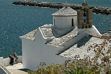
Skopelos (Greek: Σκόπελος), ancient Peparethos or Peparethus (Ancient Greek: Πεπάρηθος), is a Greek island in the western Aegean Sea. Skopelos is one of several islands which comprise the Northern Sporades island group. The island is located east of mainland Greece, northeast of the island of Euboea and is part of the Thessaly region. Skopelos is also the name of the main port and the municipal center of the island. The other communities of the island are Glossa and Neo Klima (Elios). The geography of Skopelos includes two mountains over 500 meters; Delphi (681 m) in the center of the island, and Palouki (546 m) in the southeast. With an area of 96 km² (36.6 mi²) Skopelos is slightly larger than Mykonos (85 km²) and Santorini (73 km²). The nearest inhabited islands are Skiathos to the west and Alonissos to the east.

History
In island legend Skopelos was founded by Staphylos or Staphylus (Greek for grape), one of the sons of the god Dionysos and the Princess Ariadne of Crete. Historically, in the Late Bronze Age Skopelos, then known as Peparethos (Πεπάρηθος) or Peparethus, was colonised by Cretans who introduced viticulture to the island.

Perhaps because of the legend of its founding by the son of the god of wine, the island was known throughout the ancient Greek cities of the Mediterranean Sea for its wine. The play Philoctetes (first performed at the Festival of Dionysus in 409 BC) by Sophocles includes a wine merchant lost on his way to "Peparethos - rich in grapes and wine".

In 1936 excavations in the area of Staphylos / Velanio uncovered a royal tomb of the era of Mycenaean Greece. The island was briefly under the control of the city-state Chalcis, Euboea since at least the 8th century BC.

In turn the island would come under the political influence or direct domination of:

Athens.
the Kingdom of Macedon (338 - 146 BC).
The Roman Republic (146 - 27 BC).
The Roman Empire (27 BC - 330 AD).
The Byzantine Empire (330 - 1204).
The Republic of Venice (Duchy of the Archipelago) known as Scopelo (1204 - 1538).
The Ottoman Empire (1538 until the Greek War of Independence).

 Skopelos became part of the First Hellenic Republic under the London Protocol confirming its sovereignty (3 February 1830). During World War II, Skopelos fell under Axis occupation. At first it was occupied by the Kingdom of Italy (June 1941 - September 1943) and then by Nazi Germany (September 1943 - October 1944). Skopelos and the rest of Greece returned to democratic style government in 1944.

Geography
Skopelos has the shape of a saxophone, with the "neck" pointing northwest, and the "bell" lying on the east. There are not many bays and natural harbors, and cliffs steeply fall into the sea in the greatest part of the coast. Mountains dominate the western and eastern parts of the island. There are several plains; in Staphylos, Ditropon, and Panormos. The main port of Skopelos can sometimes be closed due to northerly gales. The smaller bays of Staphylos, Agnondas on the south coast and Panormos on the west offer better protection.

Communities
The main port and municipal center of the island (Skopelos or Chora) is situated in the bay on the northern coast. It is noted for its architectural heritage. On the census of 2001, it had 3,027 inhabitants.

The second largest settlement is Glossa village, situated on the northwestern tip of the island, just above Loutraki harbour, with an elevation ranging from 200 to 300m. It is 25,4 km from Skopelos town. It is a tranquil village with traditional houses, with 1,195 residents.

Neo Klima or "Elios" is a purpose-built village constructed after the great 1965 earthquake to resettle the displaced residents of the severely damaged village of (Old) Klima. It is situated by the coast on the west side of the island. The village had 415 inhabitants in the 2001 census.

Other settlements include Staphylos, Agnondas, Panormos, Ananias, Klima, Atheato, Loutraki, Kalogeros, and Milli.

Economy
The economy of Skopelos is now fully dependent on the tourism industry which supports construction and other development related industries. Though tourism is greatest during the summer months, Skopelos is also a year round retirement destination for Northern Europeans. Some residents expected an increase in tourism due to the filming of Mamma Mia! on the island in September 2007. Agriculture, once a staple of the local economy, is in decline. Plum and almond orchards exist but are less extensive than in the past. Wine production from local grapes is minimal ever since the phylloxera blight of the 1940s destroyed the vineyards. Though there is local small scale wine production using local grapes, most wine produced on the island is for home use and much is pressed from grapes imported from Thessaly. Herding of domestic goats and domestic sheep continues and a local feta type cheese is produced from these stocks. Beekeeping and honey production have increased in recent years. Skopelos supports a small fishing fleet which fishes local waters.

The island once had a vital wooden shipbuilding industry and contributed many ships to the War of Greek Independence (1821–1831). Shipbuilding began to decline after the introduction of steamships. The Encyclop?dia Britannica Eleventh Edition (1911) stated "Almost every householder in both islands (Skopelos and Skiathos) is the owner, joint owner or skipper of a sailing ship." Today the art of building ships and boats in the traditional style is virtually nonexistent and is seen only on the repairing of small wooden vessels. Skopelos can not support its population with locally produced food and goods. Most of what is used and consumed must be imported by ship from the mainland. Prices for food and consumer goods reflect the added expense of transportation. By law the Greek government collects less Value Added Tax for food and drink purchased on the islands (8% - 16%) than for similar items purchased in mainland Greece (11% - 23%). Still, purchases of food and drink run 10 percent higher in Skopelos than on the mainland. Most building materials, including sand, must also be imported. Gasoline or petrol costs are, at minimum, fifteen percent higher than on the mainland.

Skopelos is a matrilineal society. Wealth is passed on via the female line. By custom, the parents of each Skopelitan bride provide the new couple with at least a house and some property. The house and property remain in the bride's name. This custom is particularly insular as in most other parts of Greece, especially on the mainland and Crete, wealth is patrilineal.

Local food production
Olives and olive oil: Olive oil plays a role in the Skopelos diet, being the basis of all recipes of traditional cuisine. The most prevalent olive is the "Pelion" variety, larger and rounder than the "Kalamata". For eating the olives are cured both in the unripened and the ripened stages.
Feta: A semi-soft, crumbly, well-salted white cheese made from goat milk. Used in Skopelos cheese pie and other vegetable pies, added to salads and served with meals.
Cheese Pie: Not by definition a real pie, but a tiropita, a deep fried spiral of cheese stuffed phyllo dough. The pie is generally about 15 cm in diameter and 3 cm high.
Honey: Honey in Skopelos is mainly pine honey from conifer trees and flower-honey from the nectar of fruit trees and wild flowers.
Prunes: Oven or sun dried Blue or Red Plums.

Transport
Car ownership in Greece between 1990 and 2004 increased by 121% "eurostat". Skopelos reflects this trend and the local authorities are hard pressed to deal with the increased traffic and parking issues. Along with the resident population of cars, the burden of tourist and summer resident vehicles and the availability of rental cars and motorbikes has created problems for which solutions have not yet been found. The construction of a large asphalt parking area along the waterfront in the late 1990s has done little to address the parking problems facing the town of Skopelos. During the summer the population of the island increases from about 5,000 to between 15,000 to 20,000 (est. 1993).

 The island is served by commuter hydrofoils and ferryboats from the ports of Volos Magnesia and Agios Konstantinos, Phthiotis on mainland Greece which also allows connections to and from Alonissos and Skiathos. In summer there is a ferry to and from Thessaloniki and Kymi in Euboea. Skopelos has one main road which links the three main villages by coach several times daily. In the mid 1980s the mayor's council voted to apply to the Ministry of the Interior for the construction of an airport. The application was denied. There is a heliport in case of medical emergencies.

Beaches
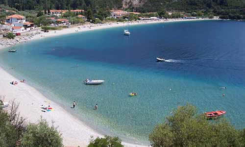
The length of the coastline of Skopelos is 67 km. Due to the island's mountainous terrain most of the coast is inaccessible. The following are beaches accessible by road or trail: Staphylos, Velanio (the unofficial nudism beach), Agnondas, Limnonari, Panormos, Adrines, Milia, Kastani, Elios, Hovolo, Armenopetra, Kalives, Glyfoneri, Glysteri, Perivoliou, Keramoto, Chondrogiorgos.


Περισσότερα►►

Skiathos - Σκιάθος


Skiathos (Greek: Σκιάθος, Latin forms: Sciathos and Sciathus) is a small Greek island in the northwest Aegean Sea. Skiathos is the westernmost island in the Northern Sporades group, east of the Pelion peninsula in Magnesia on the mainland, and west of the island of Skopelos.

Geography
The island has a northeastern to southwestern direction and is about 12 km long and 6 km wide on average. The coastline is indented with up to 65 sandy beaches, inlets, capes and peninsulas. The southeast and southwest parts have gentler slopes and that is where most of the sandy beaches, settlements and facilities are located. The terrain is hilly but more rugged on the north coast, with the highest peak at 433 m. There is a communications tower on this peak.

The main town is the Town of Skiathos (pop. 4,988 in 2001) and along with the airport are located to the northeast next to a lagoon. Other settlements along the coastline are Χanemos, Kalyvia, Troulos, and Koukounaries.

The Municipality of Skiathos includes the islets of Tsougria, Tsougriaki, Maragos, Arkos, Troulonisi and Aspronisi. They are scattered a few kilometres off the southeast coastline and are clearly visible from the town and the beaches. The larger island of Skopelos is visible from Skiathos with the more distant islands of Euboea and Skyros visible under very clear weather conditions. Total land area of Skiathos is 50 km².

The main paved road runs all along the southeastern stretch of the island with several narrow dirt roads branching off towards the interior and the northern coast. Farmland exists around all the major settlements on the island.

Despite its small size, Skiathos with its many beaches and wooded landscape is a popular tourist destination. It has over 60,mostly sandy beaches scattered all around the 44 km coastline. Some of these are Trulos, Vromolimnos, Koukounaries, Asselinos, Megali Ammos and Mandraki.

Much of the island is wooded with Aleppo Pine and a small Stone Pine forest at the Koukounaries location where there is a second lagoon and a fine-textured popular beach. The island's forests are concentrated on the southwest and northern parts but the presence of pine trees is prevalent throughout the island.

History
In Ancient times, the island played a minor role during the Persian Wars. In 480 BC, the fleet of the Persian King Xerxes was hit by a storm and was badly damaged on the rocks of the Skiathos coast. Following this the Greek fleet blockaded the adjacent seas to prevent naval invasion and provisions for the enemy of 300 Spartans who stood heroically at Thermopylae pass. The Persian fleet was defeated there at Artemisium and finally destroyed at the Battle of Salamis a year later. Skiathos remained in the Delian League until it lost its independence. The city was destroyed by Philip V of Macedon in 200 BC.

In 1207 the Gyzi brothers captured the island and built the Bourtzi, a small Venetian-styled fortress similar to the Bourtzi in Nafplio, on an islet just out of Skiathos Town, to protect the capital from the pirates. But the Bourtzi was ineffective in protecting the population and in the mid-14th century the inhabitants moved the capital from the ancient site that lay where modern Skiathos Town is to Kastro (the Greek word for castle), located on a high rock, overlooking a steep cliff above the sea at the northernmost part of the island.

In 1704 monks from Athos built the Evangelistria monastery which played a part on the Greek War of Independence as a hide-out for Greek rebels. The first flag of Greece was created and hoisted in the Evangelistria monastery in Skiathos in 1807. Several prominent military leaders (including Theodoros Kolokotronis and Andreas Miaoulis) had gathered there for consultation concerning an uprising, and they were sworn to this flag by the local bishop.

After the War of Independence and demise of piracy in the Aegean, Kastro became less important as a strategic location. In 1830s, the island's capital was moved to the original site — where it still remains. Today, ruins of Kastro are one of tourist attractions. During the 19th century Skiathos became an important shipbuilding centre in the Aegean due to the abundance of pine forests on the island. The pine woods of the island were then almost obliterated. This was brought to a halt though, due to the emergence of steamboats. A small shipwright remains north of Skiathos Town, which still builds traditional Greek caiques.

The film Mamma Mia was partially filmed on Skiathos and nearby island Skopelos. This has increased its popularity as a tourist destination since the release of the successful movie.

Hollywood actor Richard Romanus moved to the island in 2001 with his wife. He has written a book about his move to the island called "Act III".

Transportation
There is a regular boat service to the island and the rest of the Sporades islands with departures from Thessaloniki, Volos and Agios Konstantinos. The boats are operated mainly by Hellenic Seaways using its high-speed Flying Dolphin and Flying Cat vessels as well as conventional ferries.

Skiathos Island National Airport is at the northeast of the island next to a lagoon and a lowland isthmus separating the island from the peninsula of Lazareta. As of summer 2011, Skiathos airport is served by Olympic Air flights from both Athens and Thessaloniki, while foreign airlines provide charter flights from a range of airports of European countries such as the United Kingdom, France, Germany, Holland, Italy and Cyprus.

The modern major road runs along the eastern and southern coast. Narrower roads, some paved and some dirt, reach the interior and the northwest coastline. There is regular, and during tourist season, very frequent bus transit from the main town to the Koukounaries beach in the southwest.

There are three bus routes on the island. The core route is from the main town to Koukounaries beach which travels along the south coast of the island. There are in total 24 bus stops, with Koukounaries Beach being the last stop, number 24. This route operates a fleet of five coaches as frequently as five times an hour during the summer peak season throughout the day, but is significantly reduced during the winter. The second route departs from Skiathos Town, to the Monastery of Evangelistria at an hourly daily schedule and the third bus route to Xanemos on the north coast with up to six round trips daily, both operated using mini-buses.

Περισσότερα►►